 Cookie preferences
SONARWIZ


Chesapeake Technology was launched with a simple mission – to make it easy to collect and interpret sonar data by making it easy to use our products. This has driven our on-going product enhancements and technology innovations – many of which are ideas submitted by users – and our dedication to provide the best customer service in the industry. We offer custom software and hardware solutions, as well as thought-leading consulting services to the hydrographic survey, marine geophysical, and geological survey industries throughout the world.
Our flagship product, SonarWiz, provides leading-edge sonar data acquisition and processing software for sidescan and sub-bottom sonar systems being used by hundreds of clients worldwide including NAVO, NOAA, USGS, and many of the world’s navies and universities.
Chesapeake Technology, Inc. (CTI) was founded in 1995 in the heart of Silicon Valley by John Gann, who continues to serve as CTO and overall go-to guy for our customers. John travels the world giving at-sea training, meeting with customers to learn how to make our products even better, presenting at conferences, and playing hockey whenever possible.
USERS
Navies
Merchant Marines
State and Local Environmental Authorities
Energy Exploration Firms
Educational Institutions
Maritime History and Research Organizations
Dredging Operators
Telecommunications Companies
Police Departments
Coast Guard
APPLICATIONS
Archaeological surveys and expeditions
Cable and pipeline surveys
Buried object location
Geohazard surveys
Search and Recovery
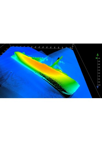
SIDESCAN
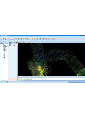
VIEW AND ANALYZE SIDESCAN DATA IN REAL TIME WITH THE INDUSTRY’S MOST COMPLETE SEAFLOOR MAPPING SOLUTION
DONGLE FREE LICENSE OPTIONS AVAILABLE NOW
The industry’s leading seafloor mapping software allows surveyors to:
Detect small targets via improved across track resolution.
Identify differences between old and new surveys through the SonarWiz transparency, swipe, or line shift tools.
Preserve the full fidelity of sonar data across multiple formats. For example SonarWiz allows for recording in industry standard XTF or vendor-specific formats such as Edgetech JSF or Kongsberg-GeoAcoustics GCF.
Simplify mission execution through the use of a single, easy-to-learn mapping solution.
Create superior contact reports thanks to improved editing features. Easily export data to a variety of formats including PDF, OpenOffice, Microsoft Word, and HTML.
Optimize time on the water through the use of sophisticated planning tools.
Reduce costs by leveraging real-time data acquisition to confirm quality and coverage prior to leaving coverage area.
Generate state of the art mosaics, contact, and waterfall imagery with high resolution 64-bit displays.
Marine Construction
Coastal Restoration
Environmental research
SUB-BOTTOM
EXPLORE SEDIMENT LAYERS IN DEPTH WITH SONARWIZ FOR SUB-BOTTOM PROFILERS WITH REAL-TIME DATA ACQUISITION AND POST-PROCESSING SOFTWARE
FEATURES
Bottom track data manually or use automated tools
Correct sub-bottom data for tide and draft variables using the Datum Align to Bathy Grid feature
Fix navigation data with NavInjectorPro
Polish your data with the Heave Compensation Swell Filter
Organize acoustic reflectors with annotations
Compare reflectors and generate thickness vectors with the Isopach and Thickness Tool
Interpret your data with zoom, pan, measurement and image scaling tools
Annotate the data using the Core Mapping Tool
Visualize multiple lines, DTMs, sonar mosaics, xyz amplitude clouds, and digitized features plus analyze intersections in the 3D Viewer
ADDITIONAL BENEFITS
The sub-bottom profiler package also includes navigation, fathometer, and magnetometer inputs so you get a broad perspective of a survey area.
Mid and post-survey digitizing tools and interactive visualization tools enable users to preview and audit data ensuring all necessary data was collected before concluding a survey.
SonarWiz saves you time with its automatic bottom tracker, semiautomatic seabed classification algorithm, and isopach and thickness tool.
A full spectrum of export options, including a wide variety of supported GIS and CAD systems – including MicroStation, AutoCAD, ArcGIS, Google Earth, and Adobe Acrobat 3D – enable you to further use and process your raw and processed data.
BATHYMETRY
CONDUCT SOPHISTICATED SEAFLOOR ANALYSIS IN REAL-TIME WITH SONARWIZ BATHYMETRY
SEAFLOOR MAPPING CHALLENGES
Mapping professionals can ill afford mistakes when launching high-stakes ocean floor survey operations. The ability to analyze and process vast amounts of data in real time can dictate the success or failure of a major mission.
THE SONARWIZ SOLUTION
SonarWiz’s easy setup allows users to maximize the time spent analyzing and interpreting data. The software’s ability to deliver sophisticated images in real time allows operators to make critical on-vessel adjustments. And SonarWiz’s post-processing capabilities allow users to analyze vast amounts of data from multiple sources within a single system.
KEY FEATURES
Quickly and easily configure sonar, sensors, and other hardware with the 3D Vessel Editor. Users can specify the type and positioning of all sensors in relation to a reference position.
Automatically calibrate sensor installation with the Patch Test Calibration utility. The utility corrects for roll, pitch, heading, position, and time offsets.
Create Whole-survey backscatter normalization for better looking mosaics.
Prepare to accept input from a wide range of sources including magnetometers, interferometers, sidescan sonars, sub-bottom profilers, and multibeam echo sounders.
Quantify the total vertical uncertainty (TVU) in your bathymetry survey using CUBE modeling and see it graphically presented. Also complies with NOAA requirements for IHO S-44 compliant surveys.
SINGLE BEAM
Cost effective single beam software
Can be used as stand alone or added to any SonarWiz module
Wide variety of Single Beam sonars supported in SonarWiz 7.0+
NMEA-0183 DBT and DPT compliant
Runs off the familiar SonarWiz GUI – easy to learn and use
Now supports SenbonDenki PDR1200
Download Single Beam Datasheet
KEY FEATURES
Cost effective software providing an upgrade path to multiple sensor types for future projects
Easy to use interface for creating surfaces for analysis
Compliant with any single beam outputting NMEA-0183 DBT/DPT
Free single beam acquisition license with any current acquisition license
DATA ACQUISITION
View single beam data in real time
NMEA-0183 compliant single beam sonars
ISA500 $ISADS – $ISADA
Odom SBT
Senbon Denki PDR
SUPPORTED VENDORS
All NMEA-0183 compliant SBES
CEE HydroSystems
Garmin
InnerSpace 400 Series (meters)
Klein
Knudsen Engineering
Kongsberg
Navico B&G
Navico Lowrance
Navico Simrad
Raymarine
Seafloor Systems
SenbonDenki PDR
SyQwest
Teledyne Odom
POST-PROCESSING
Integrate single beam with sidescan, sub-bottom, bathy and mag data sets for complete geophysical analysis.
Provides a number of editing methods to develop a clear understanding of the bottom
POST-PROCESSING FILES
SonarWiz is compatible with the following file formats:
HYPACK *.RAW
HYPACK ISA500-M39
MLG-EASYNAV
TXT
MAGNETOMETRY
HELP DIVE TEAMS AND RECOVER PERSONNEL LOCATE UNDERWATER ARTIFACTS, TREASURES AND PIPELINES YOU SEEK TO FIND, MAP OR RECOVER.
SUPPORTED VENDOR MODELS
SonarWiz for Magnetometry supports data logged as raw text and from serial port recording, whereby a channel of magnetometry data feeds into and is recorded as an embedded data channel in the sonar top-side unit in parallel with the sidescan sonar data (such as for EdgeTech and Klein models).
AquaScan AX2000
GEM 19M, 19T
Geometrics 881 & 882
Marine Magnetics Standard and with Depth
Other models can be supported – just contact us at support@chesapeaketech.com.
MAGNETOMETRY POST-PROCESSING OPTIONS
Import your magnetometry data as a text file or as an embedded channel from a sonar file. As text file magnetometry data is template-based, use any of our existing 20+ templates or ask us to create one. Templates are currently available for the following types of pre-recorded magnetometry data and many more.
Define boat specs and sensor positions relative to the vessel reference position with the Vessel Editor
Create a new project & import your bathymetric data files
Load and merge raw bathymetry data (range/angle) with attitude
data (roll/pitch/heading), sound velocity casts, tide files, and auxiliary navigation data
Magnetometry real-time acquisition is no longer automatically included with SonarWiz sidescan or sub-bottom real-time acquisition license purchases. Magnetometer data collection and/or post-processing can be added to existing licenses or sold in standalone electronic or hard dongle licenses.

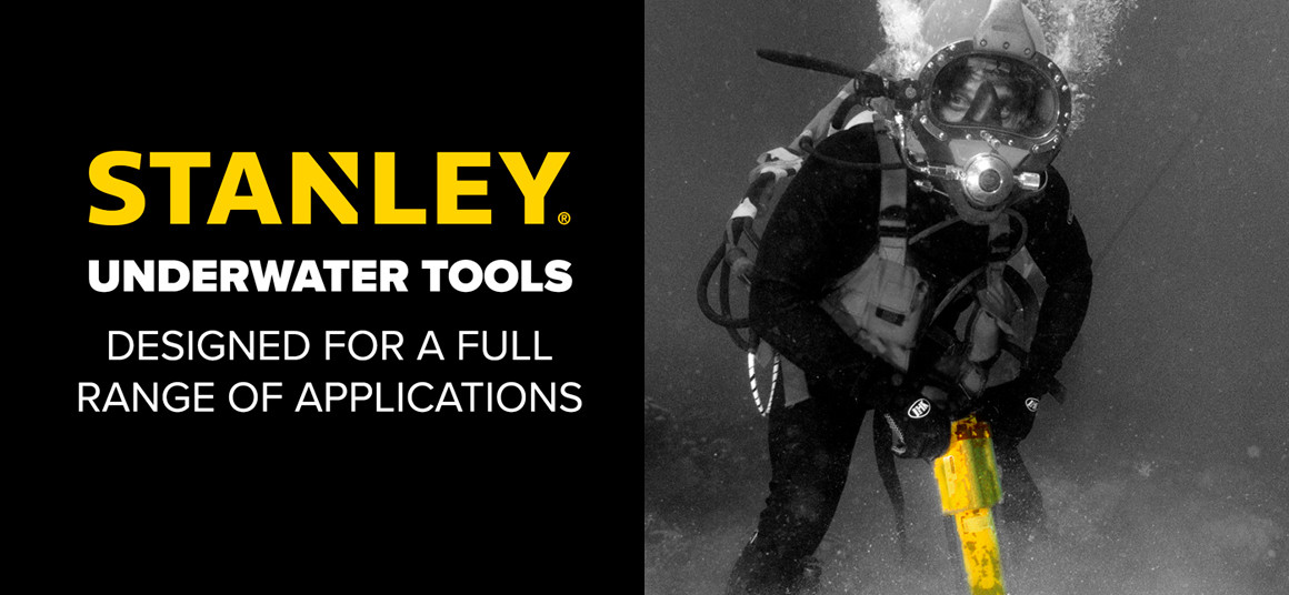
Underwater hydraulic tools from the Stanley brand are highly recognized for their...

We are pleased to announce that we will be present at the next Aquasur fair, which...

Climate change is one of the most pressing global challenges we face today,...

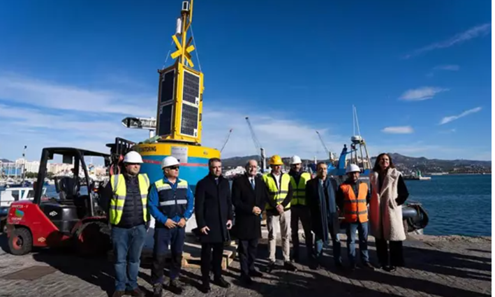
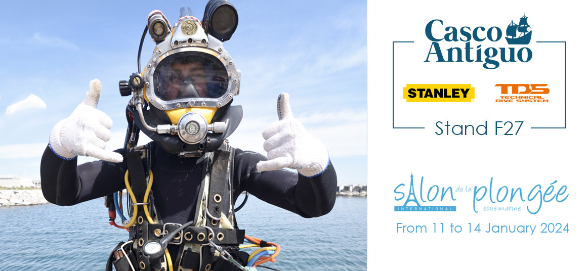
Casco Antiguo, a global supplier in the supply of underwater equipment, will...

